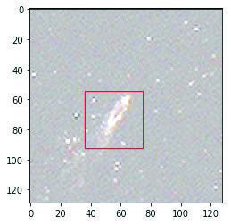
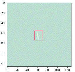
 Working as a team as part of the Canadian Space Agency’s SmartWhales programme, GSTS has created a novel whale detection and monitoring system. Data sources from a variety of satellite providers can be used to screen and detect whales if they exist at or just below the ocean surface. Data are ingested into OCIANA™ and processed into a form suitable for ‘object detection’ models (i.e., the same technology that can automatically identify people in your mobile phone’s photos). Here the task of detecting and labelling objects in an image is made significantly more difficult because of the sparsity of samples for model training: whales spend most of their time below the surface, and for NARW with a population estimated at below 350 individuals, even spotting one is rare. This issue was solved by increasing the number of samples using two different methods. Firstly, an exhaustive search
and through partnerships in the whale monitoring and research community within and outside of the SmartWhales programme, a wide array of samples were obtained to provide a representative suite of whales as seen from space, in a variety of conditions. Concurrently, image augmentation methods were used to artificially increase the sample size available for model training. Through the combined effect of these strategies, a model could be trained with high accuracy for detection of NARW from satellite imagery.
A model is only useful if the information generated from the model is used to enhance decision-making or achieve a desired outcome. This is especially true in a context such as endangered species conservation, where all efforts must be made to act quickly and consistently. Deploying AI models as operational tools is an extremely challenging task: data ingestion pipelines need to be developed, models deployed, data orchestration pipelines created, parameter files created, UI elements built and configured, and results need to be continually monitored and issues that arise fixed. Moving from a theoretical model to an operational model makes all the difference for achieving concrete conservation goals, and in this case, having the best chance to detect, monitor, and conserve NARW.
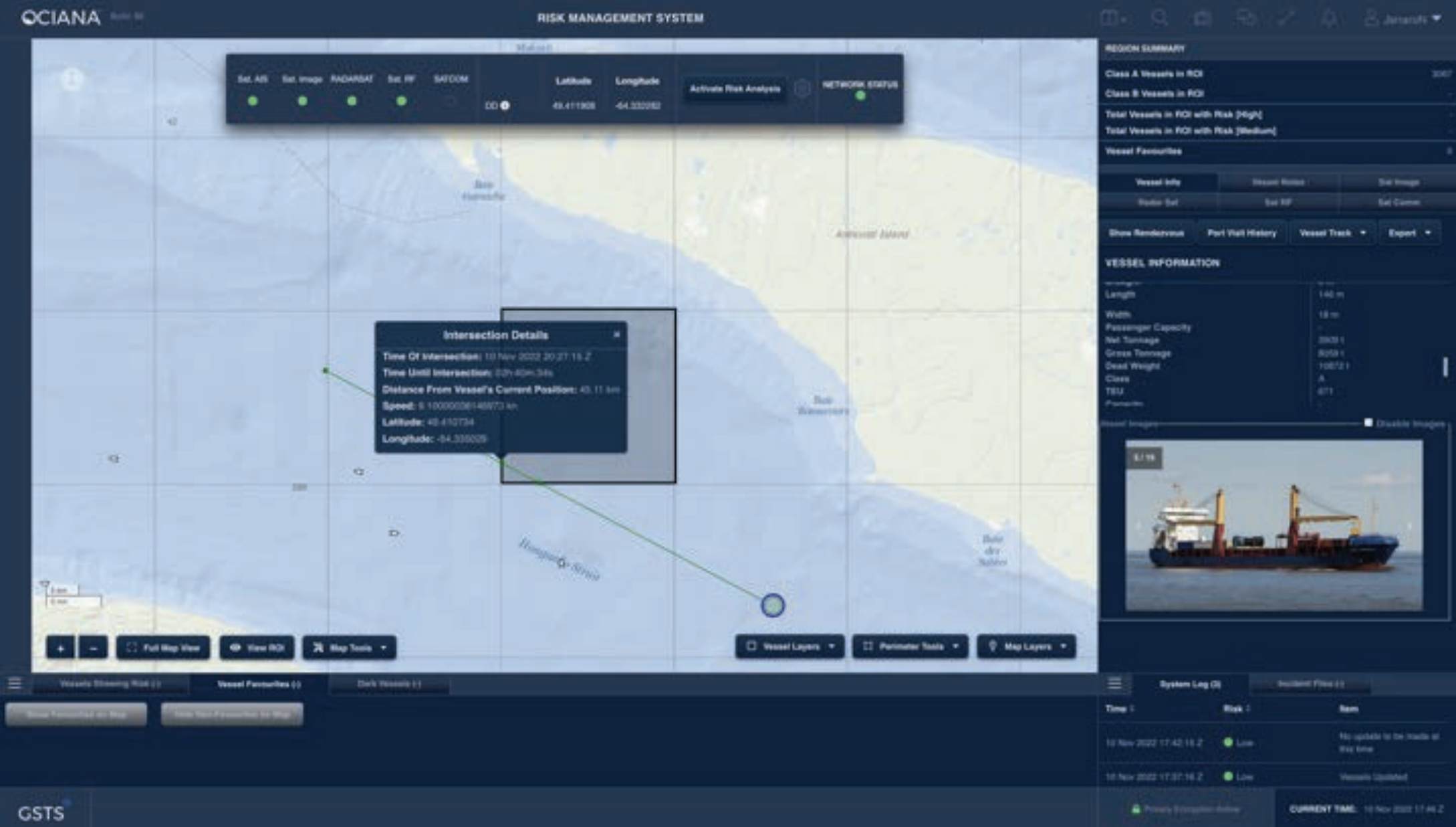
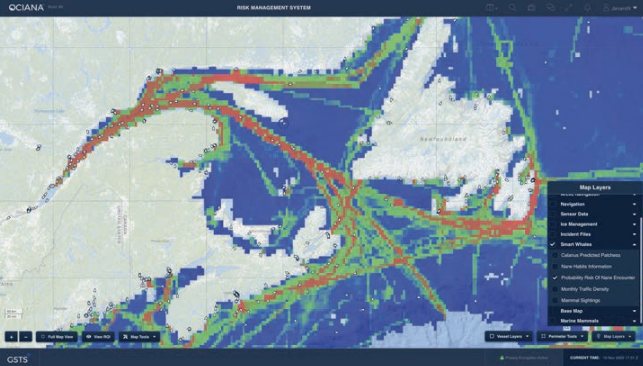
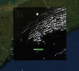
Of secondary importance to making models useful, is to bring model results into a format that a decision-maker can use. Here, we deployed our whale detection model into OCIANA™, GSTS’ unique maritime AI platform. Several additional capabilities were developed including the implementation of a dynamic whale risk model which incorporated environmental data on predicted location and abundance of its primary food source (copepods of the genus Calanus), as well as historical vessel traffic. For detections that occurred we could use vessel path prediction tools to look for potential collision risks. Such data provides unprecedented intelligence to seafarers and navigators operating in NARW habitat. Through the integration of several key data sources with AI-based models and our maritime AI platform, concrete outcomes can be achieved in terms of enhanced operational decision-making to reduce risks to NARW.
Artificial intelligence provides a brand new set of tools to generate insights into some of the world’s most pressing problems. However, the tools themselves are not enough: the information generated from AI models must be integrated with other models and data sources and delivered with intuitive user interfaces. GSTS has developed world-leading capabilities in maritime AI, and can bring these tools together into bespoke solutions – to reduce GHG emissions, to reduce maritime risks, and even to help save the whales.