Our platform transcends traditional products, offering sophisticated planningand forecasting capabilities to guide your every decision. OCIANA® enables ports to benefit from enhanced real time predictive visibility and actionable insights for inter-modal operations as well as environmental performance management.
Prediction of ice jams 7 days prior to facilitate advanced planning and scheduling of alternate berthing windows
Enables prioritisation of resource deployment and management
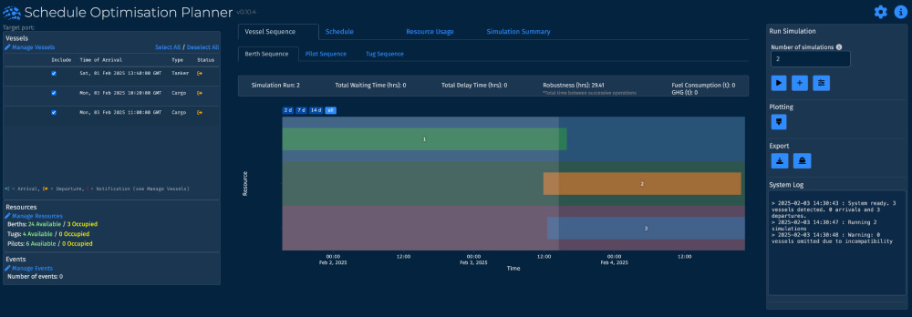
Schedule Optimisation Planner (SOP)
Provides ports with advanced planning and optimal scheduling for vessels
Facilitates quick recovery from shock events
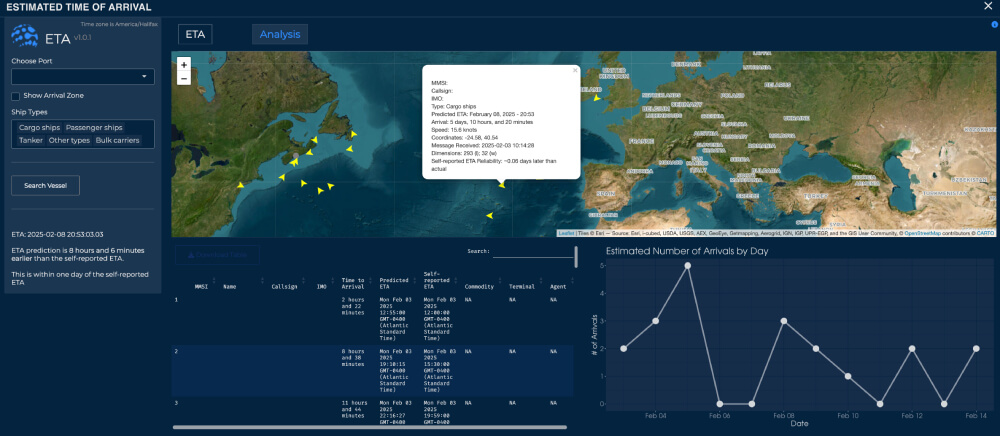
Predicts vessel behaviour, arrival time and deviations
Enables simulation–optimisation for resource usage based on reducing vessel wait times, decreasing emissions and enhancing robustness in berth scheduling
Advanced Chat and Collaboration Tools
Facilitates single reference for all users of data and real time communication and collaboration
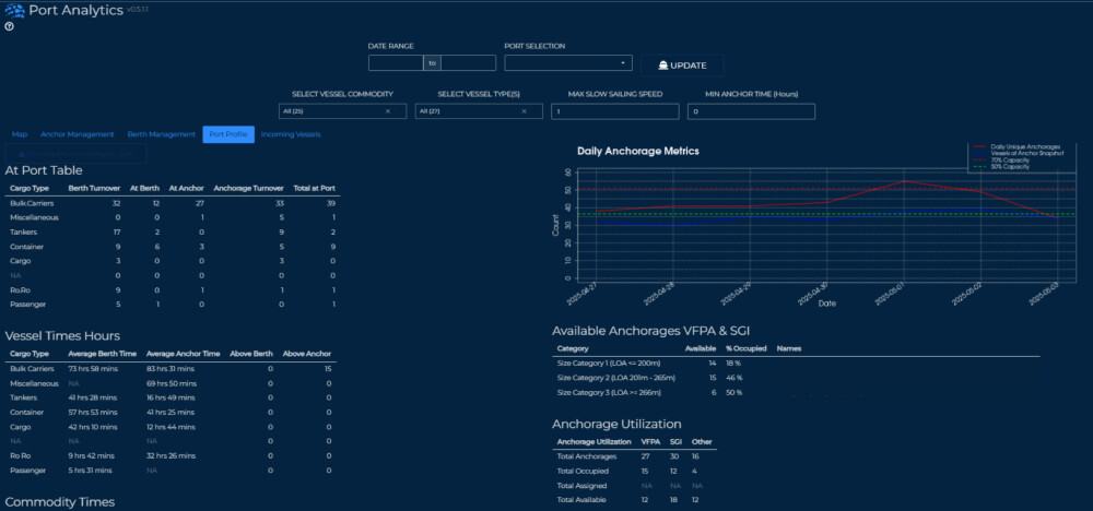
Anchorage: allows users to visualise, manage and report on vessel wait time based on arrival and departure, slow downs, destinations and historic behaviour
Vessel Berthing Reporting: enables full view of all berths capacity and metrics to determine average berthing times
Port Profiles: enable current and historic behaviour comparison vis a vissister and competitor ports
Green Digital Shipping Corridor
Digitized trade routes for all vessels that arrive at port
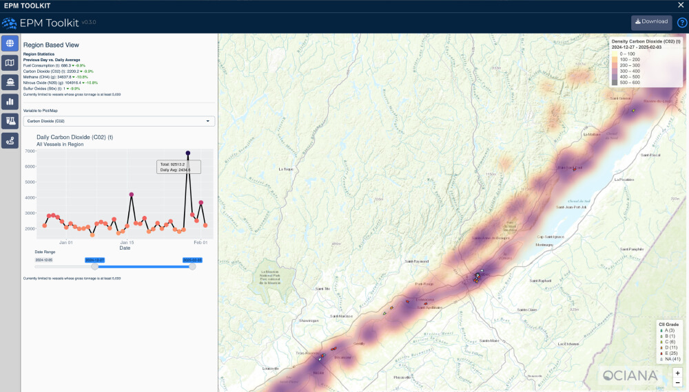
Monthly reporting for fuel consumption and emissions along segments of a vessel route or along series of port visits
Intelligent Geofencing
Geofences enhanced with machine learning to deliver a high accuracy timeline and enhanced predictability into a vessel’s location and planned passage
Real time visibility
Enhanced predictability
Integrated inter-modal operations
Accelerate Your Maritime Business Today with AI-Powered Intelligence