Vessel Optimiser

OCIANA®: Your Digital Anchor in Uncertain Times

OCIANA® offers a holistic solution for the maritime industry, delivering real-time predictive insights and risk assessments that help optimise vessel performance, efficiency and sustainability. OCIANA® provides a dynamic view of vessel operational and behavioural patterns on route, distance, speed, fuel consumption and emissions to enhance port collaborative decision making.
ETA Prediction

Provides the most accurate long-horizon, multi-stop ETA predictions for liners and tramp vessels 

Enables user to form independent assessment on vessel reliability towards port, enabling JIT arrivals and operations streamlining

Voyage Report

Enables user to form independent assessment on vessel reliability towards arrival at port   

Independent reports with historic and real-time data on ship movements and environmental factors that affect the voyage offering weather and performance data at configurable intervals - actual data can be exported at any time

Collaborative Optimisation Solution

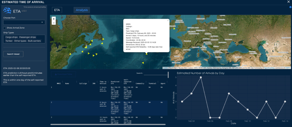
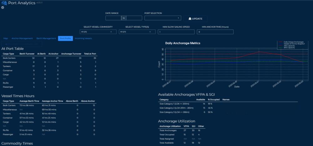
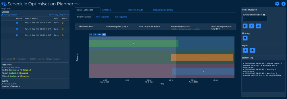
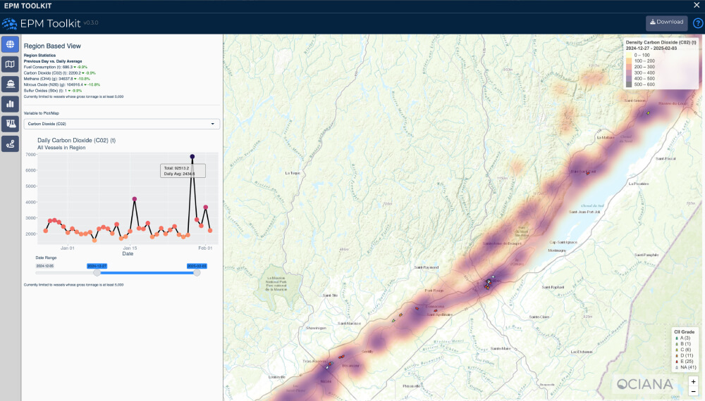
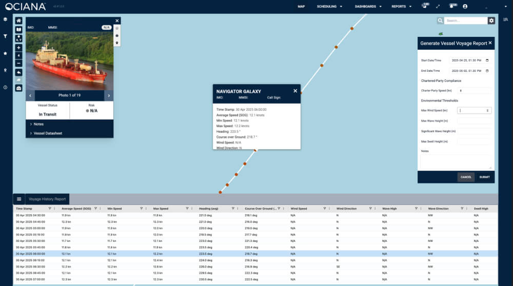
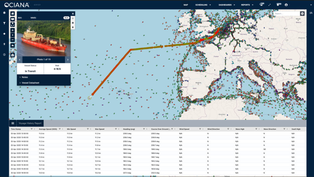
A unique ship-to-port interface that facilitates the collaboration between vessels, ports, port services and authorities (e.g., pilotage services, harbour masters etc.), providing real-time information on vessel movements, berthing options, and potential delays

Minimizes time at anchorage and empowers ships to optimise their steaming speeds, ensuring timely arrivals based on berth availability

Enhanced Pre-Arrival Notifications

Smart forms which facilitate vessels to submit pre-arrival reports in a direct interface with the port, eliminating paperwork and reducing excessive emails

Real-Time Analytics

Ability to view real-time data on port congestion, turnaround time at berth, number of vessels at anchor and probability of anchorage and berth availability at the requested time

Intelligent Geofencing

Configurable geofences, enhanced with machine learning, to deliver a high accuracy timeline and enhanced predictability into a vessel’s location and planned passage  

Vessel Moving Haven

Allows an operator to monitor a region in a similar manner as a geofence  

Facilitates enablement of alerts for vessels based on speed, if a
vessel goes dark, and perimeter entry and exit

Designed to track a vessel’s movement along its path, including when it may not be sending AIS messages, or not at the frequency desired for updated movements

Fleet Analytics

Capability to store information for individual vessels, fleets, bespoke groups and ability to benchmark with other fleets and/or vessels outside of fleet using filter and search – data points include GHG emissions, vessel trade routes, port calls, tonnage in specific locations etc

Accelerate Your Maritime Business Today with AI-Powered Intelligence

Discover How OCIANA® can help.
en_USEnglish