
In the age of information warfare and network-centric operations, modern military and security forces rely on systems that turn data into understanding, speed, and decisive action. Nowhere is this truer than at sea, where vast, open oceans conceal threats ranging from illegal fishing and piracy to gray-zone operations and geopolitical brinkmanship.
At the heart of this capability set is C4ISR, an acronym that encapsulates the technologies and processes that give commanders an operational edge. In this blog, we answer the question of “What is C4ISR?” and its role in modern defence.
What is C4ISR?
C4ISR (Command, Control, Communications, Computers, Intelligence, Surveillance, and Reconnaissance) is the integrated architecture that enables joint and combined forces to achieve decision advantage across land, maritime, air, cyber, and space domains. It connects sensors, platforms, command elements, and effectors into a coherent system that supports the full intelligence cycle and operational kill chain.
Rather than simply aggregating data, C4ISR provides the mechanisms for collecting, processing, exploiting, and disseminating intelligence at the speed of relevance. It underpins mission command by enabling commanders to exercise authority with shared situational awareness, resilient communications, and synchronized fires in contested and denied environments.
Often described as the “nervous system” of modern armed forces, C4ISR links tactical edge sensors to operational and strategic decision-makers. In peer and near-peer conflicts, where electromagnetic spectrum congestion, cyber threats, and space degradation are expected, its resilience, interoperability, and security are as critical as its analytic capability.
Effective C4ISR architectures reduce decision latency, enhance joint interoperability, and enable coordinated multi-domain operations.
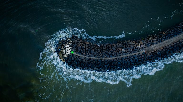
Why C4ISR matters for Maritime Domain Awareness
Maritime Domain Awareness (MDA) is the maritime application of C4ISR capabilities to enable persistent awareness, decision superiority, and coordinated effects across open oceans, littoral regions, chokepoints, and coastal approaches. It supports both peacetime security operations and high-end naval warfare.
In operational terms, maritime C4ISR enables:
- Persistent tracking of surface and subsurface contacts — fusing AIS, radar, EO/IR, SIGINT, acoustic sensors, satellite ISR, and other sources to maintain a recognized maritime picture (RMP) of cooperative and non-cooperative vessels.
- Pattern-of-life and anomaly detection — identifying irregular behaviors such as illegal, unreported and unregulated (IUU) fishing, sanctions evasion, gray-zone activity, or covert logistics networks.
- Threat detection and early warning — including piracy, maritime terrorism, hybrid threats, undersea infrastructure interference, submarine incursions, and maritime militia operations.
- Coordinated joint and interagency response — synchronizing naval, coast guard, maritime patrol aviation, customs, and law enforcement elements, often within multinational or coalition frameworks.
Unlike land or air domains, the maritime environment presents distinct operational challenges: vast geographic scale, sparse sensor density, limited infrastructure, intermittent or satellite-dependent communications, and heavy civilian traffic intermingled with military activity.
As a result, maritime C4ISR architectures must emphasize wide-area surveillance, long-endurance ISR platforms, secure beyond-line-of-sight communications, and resilient data fusion across classified and unclassified networks.
From sensors to situational awareness
A key strength of C4ISR in the maritime context is multi-source fusion, which is the ability to combine diverse sensor data into a coherent picture. At sea, this includes:
- Automatic Identification System (AIS) — ships broadcast identity, position, speed, and other data that helps build an initial layer of awareness.
- Radar and EO/IR imagery — detect and track vessels beyond AIS coverage, including those that turn off transponders.
- Satellite surveillance — gives wide-area views and complements ground and airborne sensors.
- Radio frequency (RF) and signals intelligence — capture communications and electronic emissions.
- Behavioural analytics and AI — identify patterns and anomalies, predicting potential risks before they escalate.
A truly effective maritime C4ISR system doesn’t just show “what” and “where”. Instead, it helps interpret intent, risk, and potential actions. This is the difference between raw surveillance and operational maritime domain awareness.
COP and decision advantage
A foundational construct in military C4ISR and Maritime Domain Awareness is the Common Operating Picture (COP), a continuously updated, authoritative representation of the operational environment shared across command echelons and mission partners. The COP underpins mission command by ensuring that commanders and operators act from a synchronized, near-real-time understanding of the battlespace.
In maritime operations, the COP integrates multi-source data, including AIS, radar tracks, satellite ISR, acoustic sensing, meteorological inputs, geospatial intelligence, and classified reporting into a fused Recognized Maritime Picture (RMP). This consolidated view supports surface and subsurface tracking, risk assessment, and the identification of anomalous or hostile behavior across open ocean and littoral environments.
More than a visualization tool, the COP reduces decision latency and enables coordinated, effects-based action. Whether monitoring a non-compliant fishing fleet engaged in illegal, unreported and unregulated (IUU) activity, responding to a search and rescue (SAR) incident, protecting critical maritime infrastructure, or cueing a patrol asset to intercept suspected illicit trafficking, commanders rely on the COP to manage uncertainty, prioritize assets, and synchronize joint and interagency responses.
Air and space assets, too
Maritime Domain Awareness extends well beyond surface vessels and coastal radar chains. In contemporary C4ISR architectures, airborne and space-based ISR assets are integral to achieving persistent, multi-domain maritime surveillance, particularly across vast ocean areas and contested regions.
- Maritime Patrol Aircraft (MPA) provide long-endurance, wide-area surveillance and anti-submarine warfare (ASW) capability. Equipped with maritime search radar, electro-optical/infrared (EO/IR) systems, sonobuoys, magnetic anomaly detectors (MAD), and electronic intelligence (ELINT) suites, MPAs contribute to both surface target tracking and subsurface threat detection. They play a critical role in cueing naval forces and maintaining the Recognized Maritime Picture (RMP).
- Unmanned Aerial Systems (UAS) enhance persistence and reduce operational risk by extending ISR reach beyond the horizon. High-altitude, long-endurance platforms and tactical shipborne UAVs support surveillance, target identification, communications relay, and battle damage assessment—often operating as force multipliers within distributed maritime operations.
- Space-based ISR assets provide strategic-level, wide-area coverage through synthetic aperture radar (SAR), electro-optical imaging, signals intelligence, and satellite AIS. They enable persistent monitoring of sea lines of communication (SLOCs), remote chokepoints, and gray-zone activity in areas beyond terrestrial sensor coverage. In degraded or denied environments, resilient satellite communications (SATCOM) are also essential for maintaining command and control.
Modern naval C4ISR systems integrate radar, sonar, communications, cyber, and electronic warfare capabilities across ships, submarines, coastal stations, airborne platforms, and space-based assets. This layered, multi-domain approach reduces surveillance gaps and increases responsiveness against both conventional and hybrid maritime threats.
AI and behavioural analytics at sea
One of the most consequential developments in modern C4ISR, particularly within Maritime Domain Awareness, is the integration of artificial intelligence (AI), machine learning (ML), and advanced behavioural analytics into ISR and decision-support architectures. These capabilities are increasingly central to achieving decision superiority in data-saturated maritime environments.
AI-enabled systems can:
- Identify deceptive or anomalous vessel behaviour — detecting AIS spoofing, dark vessel activity, coordinated rendezvous, loitering patterns, or unexpected course and speed deviations indicative of sanctions evasion, illicit trafficking, or gray-zone operations.
- Conduct predictive risk modelling — correlating historical pattern-of-life data with real-time inputs to forecast likely threat vectors, high-risk zones, or emerging maritime activity clusters.
- Prioritize targets and allocate ISR assets dynamically — enabling commanders to focus limited surveillance and interdiction resources on contacts of highest operational relevance.
By automating large-scale data ingestion and fusion across satellite AIS, SAR imagery, radar tracks, SIGINT, environmental data, and intelligence reporting, AI-driven analytics reduce cognitive burden and compress the sensor-to-decision timeline. Rather than replacing human operators, these systems augment analyst workflows by surfacing high-confidence alerts and decision-ready insights.
Interoperability and coalition operations at sea
Maritime C4ISR is inherently multinational and interagency in character. Effective Maritime Domain Awareness depends on national capabilities and the ability to operate within coalition frameworks that share information securely, selectively, and at operational tempo.
Interoperability across navies, coast guards, border protection agencies, customs authorities, and intelligence services ensures that sensor data, threat assessments, and operational directives can be exchanged across classification boundaries and sovereign networks. This requires adherence to common data standards, secure cross-domain solutions, federated identity management, and agreed operational procedures.
Initiatives such as the Common Information Sharing Environment (CISE) in Europe exemplify efforts to integrate national maritime surveillance systems into a cooperative architecture. By linking disparate maritime authorities through interoperable platforms, CISE enhances shared situational awareness, reduces duplication of effort, and strengthens coordinated response across member states.
In crisis response, humanitarian assistance and disaster relief (HADR), search and rescue (SAR), counter-piracy operations, or multinational maritime security missions, shared C4ISR capabilities enable coalition forces to synchronize actions rather than operate in parallel.
C4ISR challenges and opportunities
Despite its operational value, maritime C4ISR faces persistent and evolving challenges, particularly in peer and near-peer threat environments:
- Cyber and electromagnetic spectrum (EMS) threats — adversaries may target communications links, satellite dependencies, data repositories, and sensor networks through cyber intrusion, jamming, spoofing, electronic attack, or anti-satellite (ASAT) capabilities. Protecting data integrity, ensuring continuity of command, and operating in degraded or denied environments are now baseline requirements.
- Data saturation and cognitive burden — modern maritime surveillance architectures generate enormous volumes of multi-source data. Without effective fusion, automation, and decision-support tools, the volume of raw inputs can overwhelm analysts and slow operational response.
- Scalability and persistence across vast operating areas — the maritime domain’s geographic scale, sparse infrastructure, and limited basing options demand distributed, resilient architectures capable of wide-area coverage and long-duration endurance.
To address these challenges, next-generation maritime C4ISR architectures are increasingly incorporating secure cloud environments, edge computing, AI-enabled analytics, unmanned and autonomous sensor networks, and proliferated space-based constellations. These technologies support distributed maritime operations, enhance survivability, and reduce reliance on single points of failure.
Future systems will emphasize human-machine teaming, where autonomous analytics processes and triage data at scale while commanders retain judgment and authority over operational decisions.
OCIANA: Advancing C4ISR Modernization
In an era defined by renewed great-power competition, Arctic accessibility, grey-zone maritime activity, and increasingly contested supply chains, maritime C4ISR systems are foundational to national defence and security priorities.
Aligned with Canadian and allied modernization priorities, including Arctic domain awareness, NORAD renewal, NATO interoperability, and integrated multi-domain operations, OCIANA enhances sovereign awareness while strengthening coalition readiness. Capabilities include:
Arctic and Northern Domain Awareness Enablement – Supports persistent monitoring across Canada’s Arctic approaches, northern sea routes, and remote littoral zones for sovereignty assertion, environmental protection, and early warning integration consistent with NORAD modernization objectives.
Cross-Domain ISR Integration – Enables coordinated naval range clearance, airborne ISR cueing, littoral interdiction, SAR coordination, border integrity missions, and joint force intelligence operations within a unified operational intelligence fabric to support Joint All-Domain Command and Control (JADC2)-aligned architectures.
Unified Maritime Common Operating Picture – Fuses AIS, radar, EO/IR, satellite, METOC, acoustic, and mission reporting data into a single authoritative maritime picture accessible across ships, aircraft, intelligence centres, joint task forces, and remote northern installations.
Grey-Zone and Hybrid Threat Detection – Identifies AIS manipulation, dark vessel behaviour, sanctioned shipping networks, suspicious rendezvous patterns, corridor deviations, and other indicators associated with hybrid maritime activity to detect and respond below the threshold of open conflict.
Predictive and Continuous Learning Analytics – Continuously refines behavioural models through operator feedback and mission outcomes, contributing to a growing sovereign maritime intelligence corpus while enabling coalition data collaboration under secure federation protocols.
Forensic Reconstruction and Evidence-Grade Reporting – Delivers synchronized, time-layered replay of multi-source vessel activity to support interdictions, Arctic sovereignty enforcement, fisheries protection, sanctions monitoring, and evidentiary documentation aligned with many legal standards.
Human-in-the-Loop Command Augmentation – Provides transparent, auditable decision-support recommendations that accelerate operational tempo while preserving command authority and ensuring compliance with many defence AI governance principles.
Federated, Sovereign Information Sharing – Enables secure, role-based collaboration across navies, coast guards, joint forces, law enforcement, and Public Safety partners, while preserving jurisdictional control, classification boundaries, and data sovereignty.
C4ISR Integration and NORAD Modernization Readiness – API-driven, modular, and zero-trust secure architecture designed to integrate with existing defence systems.
Contact us to learn more about OCIANA®.
FAQs
C4ISR stands for Command, Control, Communications, Computers, Intelligence, Surveillance, and Reconnaissance. It describes the integrated capabilities that enable military forces to gather, process, share, and act on information securely and effectively. In the maritime domain, C4ISR connects ships, aircraft, satellites, coastal radars, and command centers to monitor vessel activity, detect threats, and coordinate responses across oceans and littoral waters.
A C4ISR system is an integrated network of hardware, software, sensors, communication platforms, and command centers that collect, process, and distribute operational information to decision-makers. It includes:
- Communication networks
- Computing infrastructure
- Intelligence analysis tools
- Surveillance sensors
- Reconnaissance platforms
A maritime C4ISR system integrates AIS data, radar feeds, satellite imagery, airborne surveillance, and AI analytics into a common operating picture for navies, coast guards, and maritime authorities.
A C4ISR architecture defines how all system components — sensors, networks, computing platforms, and command structures — connect and interact. It ensures interoperability, data flow, cybersecurity, and scalability.
In maritime operations, a C4ISR architecture ensures that ships, aircraft, satellites, and coastal stations can share data seamlessly, forming a unified maritime common operating picture across vast ocean regions.
In the Army context, C4ISR refers to the digital systems that support land forces, including battlefield communications, intelligence analysis, reconnaissance drones, and command posts.
C4ISR facilities are physical or virtual locations where command, intelligence processing, and communications operations occur. These include command centers, intelligence fusion centers, data centers, and network operations centers.
In maritime security, C4ISR facilities include coastal operations centers, naval headquarters, maritime fusion centers, and airborne mission control stations that process surveillance data and coordinate responses.
General users:
- Armed forces (Army, Navy, Air Force)
- Intelligence agencies
- Defense ministries
- Coalition alliances
- Homeland security agencies
Maritime users:
- Navies
- Coast guards
- Maritime security agencies
- Port authorities
- Border control agencies
- International maritime coalitions
Increasingly, commercial maritime intelligence providers also use C4ISR-like architectures to support sanctions monitoring, risk analysis, and maritime transparency.
C4ISR is important because it enhances situational awareness, accelerates decision-making, enables coordinated operations, improves resource allocation, strengthens cybersecurity, and supports interoperability. It gives forces decision superiority in complex, multi-domain environments.
In the maritime domain, C4ISR is critical it enables maritime domain awareness by turning sensor data into intelligence and intelligence into action. It is the foundation for safe navigation, secure trade routes, environmental protection, and national security at sea.
The difference between C4ISR and C5ISR is that C5ISR adds Cyber capabilities to the existing C4ISR framework. The addition reflects the reality that modern military networks are not only tools for communication and intelligence but also targets in contested digital environments.
C4I stands for Command, Control, Communications, Computers, and Intelligence. It is an earlier version of the broader C4ISR concept and focuses primarily on command networks and intelligence support systems rather than the full sensor and surveillance ecosystem.
The difference between C4I and C4ISR is the addition of Surveillance and Reconnaissance capabilities. C4I focuses on decision-making authority, communication networks, computing infrastructure, and intelligence analysis. C4ISR expands that framework by including the systems that collect raw data from the operational environment, such as radar, satellites, drones, and sensors.
C4ISR is used in disaster response to provide real-time situational awareness, coordinate multiple agencies, and manage logistics and communications during emergencies. It helps create a common operating picture that allows decision-makers to allocate resources efficiently and respond quickly to changing conditions. Surveillance platforms, secure communications networks, and intelligence analysis tools all contribute to effective crisis management.
In maritime disaster response, C4ISR supports search-and-rescue operations, oil-spill monitoring, hurricane impact assessments, and coastal evacuation coordination. Airborne ISR platforms and satellites provide rapid imagery of affected coastal areas, while command centers coordinate naval vessels, coast guard units, and humanitarian agencies. By integrating data and communications, maritime C4ISR systems significantly reduce response times and improve operational coordination.
The main challenges of C4ISR include interoperability issues, legacy systems, cybersecurity threats, data overload, complex procurement processes, and high implementation costs. Many defence organizations still operate stove-piped systems that are difficult to integrate. At the same time, C4ISR networks are increasingly targeted by cyberattacks and electronic warfare. The large volume of sensor data can also overwhelm analysts without advanced analytics and artificial intelligence.
In the maritime domain, additional challenges arise from the vastness of the ocean, limited satellite bandwidth, harsh environmental conditions, and deceptive vessel behaviour such as AIS spoofing or dark shipping. Coordinating data sharing between navies, coast guards, port authorities, and international partners further increases complexity. Overcoming these challenges requires resilient digital architectures, AI-enabled data fusion, and strong cybersecurity integration across maritime networks.